 I can’t say enough about how beautiful it is in the Pacific Northwest. From the amazing Mt. Hood glacier and the Mt. St. Helens volcano, to the most ruggedly beautiful coastline in the USA — an outdoor enthusiast (or anyone with a camera) could live a lifetime here and not see it all.
One way to see a wide swath of Northwest scenery is to go on a tour of our lighthouses.
I put together a set of Oregon lighthouse postcards in 2011. When I recently ran into a printed set, I thought I’d put it all here to share. Following is the information I collected for this project. Click on each of the images below for a much larger version. I did not take any of these photos myself, and sadly I cannot find my notes on the photos’ sources. I usually am extremely careful not to use copyrighted material, so hopefully that’s the case here!
Much of the text of the descriptions originally comes from www.lighthousefriends.com.
For more reading, if lighthouses are your thing, check out this impressively detailed article about Oregon and California lighthouses. And here are some nice posts from my friend at Makin’ Trax about the Yaquina Head and Umpqua Bay Lighthouses, and about the Oregon lighthouses in general.
Cape Arago Lighthouse
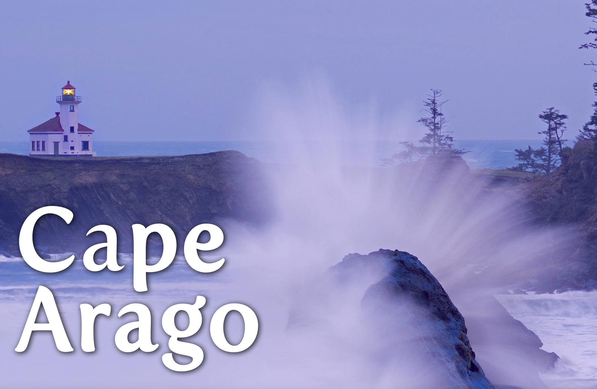
Located on Chief’s Island just off a section of the Oregon coast roughly 10 miles southwest of Coos Bay.
Just south of Coos Bay and 2.5 miles north of Cape Arago (originally known as Cape Gregory), is a small, detached piece of land with sheer cliffs called Chief’s Island by the Coos Indians. The shape of the island has been aptly described as a bony right-hand fist, with an extended index finger pointing northward. It was on the tip of this finger-like extension that the first Cape Arago Lighthouse was erected in 1866. Oregon’s first lighthouse was built in 1855-1856 near the mouth of the Umpqua River, twenty-five miles north of Coos Bay. However, in 1861 the overflowing river undermined the brick tower, causing it to topple. By this time, the Coos Bay area had surpassed the Umpqua River region in commercial importance, and it was decided that the interests of commerce would be better served by a new light at Cape Arago, rather than reconstructing the light at Umpqua River. Funds were allocated accordingly, and November 1, 1866, the first Cape Arago Lighthouse was illuminated.
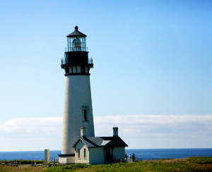
Yaquina Head Lighthouse
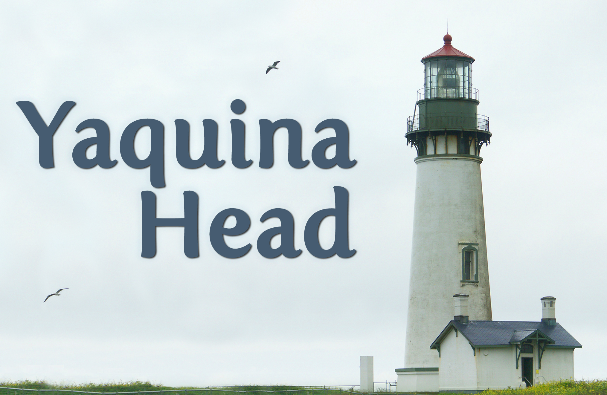
Open to the public only during daylight hours, this lighthouse is located one mile west of Agate Beach.
Said to be haunted, there was trouble with the Yaquina Head lighthouse from the beginning. Construction began in the fall of 1871 but was often delayed due to the tempestuous Oregon winter. Boats bringing materials had difficulty landing in a cove on the south side of the head, and at least two boats were overturned in the surf losing their cargo. The fact that a lighthouse was even meant for Yaquina Head has come into question, as some say the lighthouse was intended for Cape Foulweather, about six miles north. The tower, made from 370,000 bricks from San Francisco, is double walled for insulation and dampness protection. One story tells of a workman falling from the scaffolding into the space between the masonry walls where his body could not be retrieved. A fine story, and perhaps an explanation for the station’s purported ghost, but records show no workers were killed during construction.
Umpqua River Lighthouse
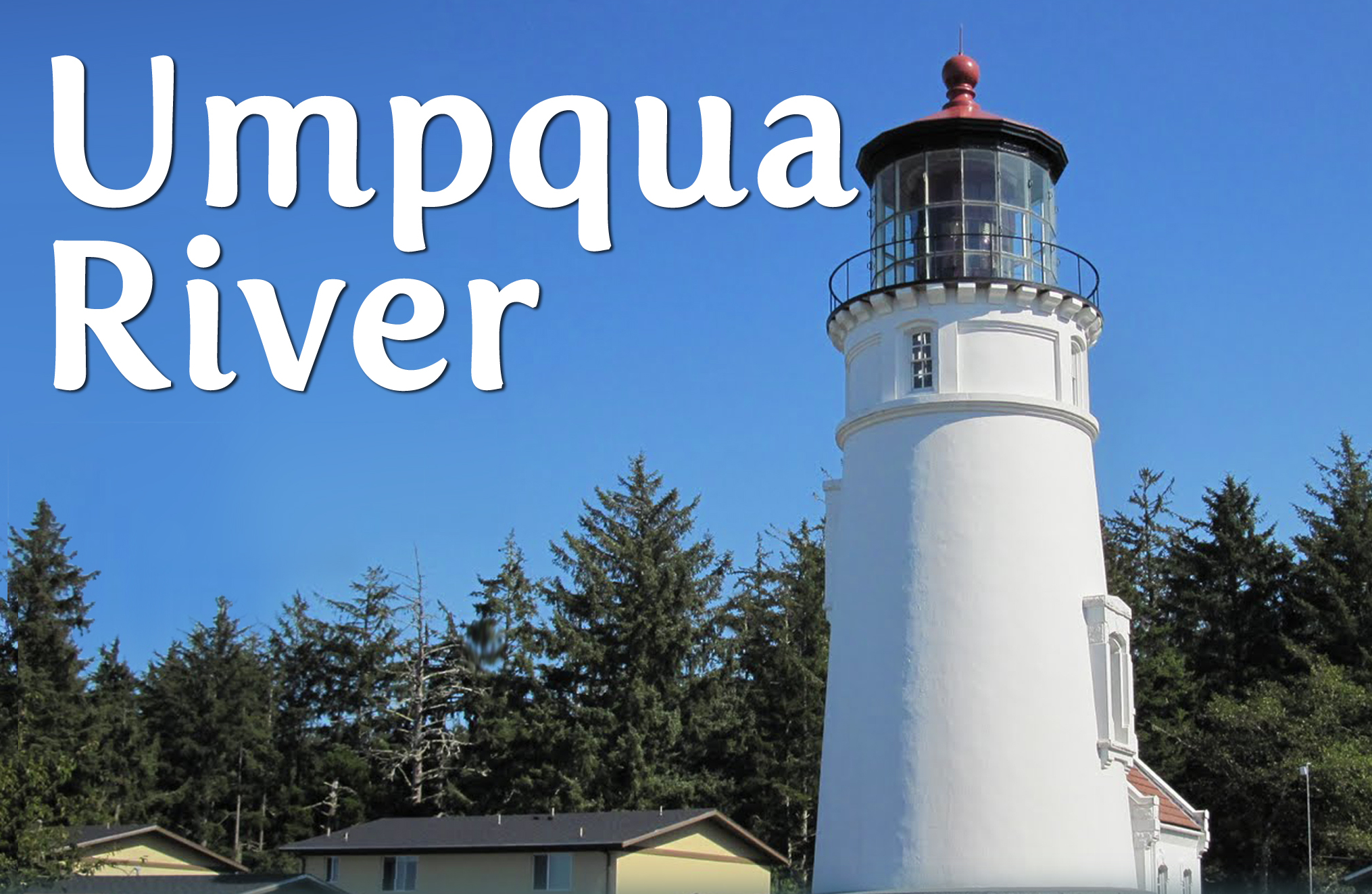
Located on a slope overlooking the entrance to the Umpqua River, surrounded by Umpqua Lighthouse State Park.
Construction on the Umpqua River Lighthouse, the first lighthouse in the Oregon territory, began in 1856. The Umpqua River mouth was selected as one of only six sites in the Oregon territory, which included the modern day states of Oregon and Washington. Many thought the Umpqua River area would become a major shipping center due to its abundance of “green gold,” the pristine timber rapidly being harvested. The turbulent force with which the river collided with the ocean created a great hazard for ships, and a beacon marking the spot was greatly needed. In 1851, Congress appropriated $15,000 for the Umpqua River Lighthouse and 33 acres were set aside for the site. Work was delayed when on September 13, 1853, the supplies for the light were destroyed when the schooner “Oriole” foundered just off Cape Disappointment.
Cape Meares Lighthouse
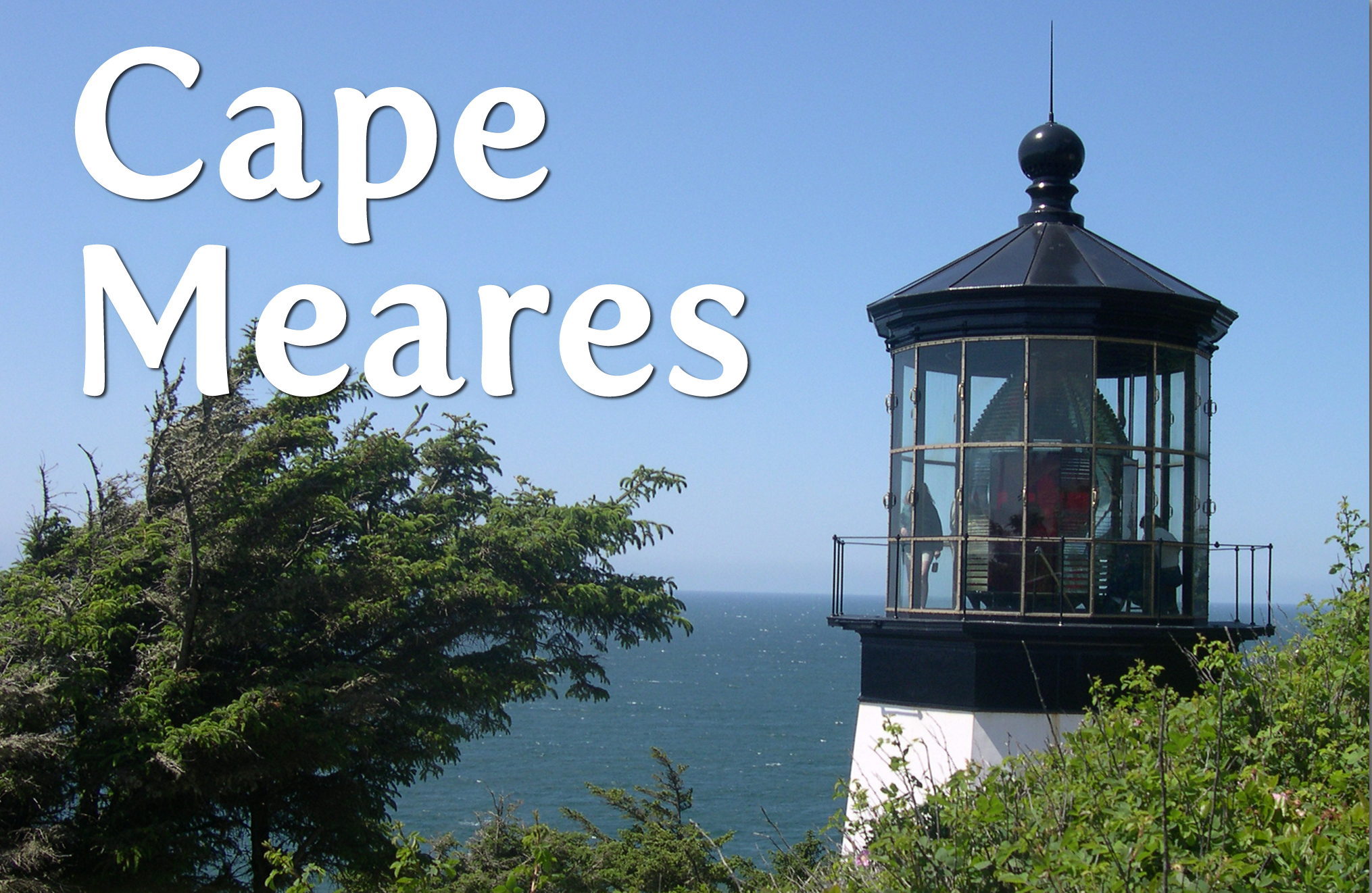
Located in Cape Meares State Scenic Viewpoint, roughly 10 miles northwest of Tillamook.
Cape Meares lighthouse sits at the north end of the beautiful 20-mile Three Capes Scenic Loop along the Oregon coast. Originally, Cape Meares was named Cape Lookout by explorer Captain John Meares in 1788. Nautical charts produced in 1850 and 1853 mistakenly put the name on another cape 10 miles south. By the time the mistake was realized, the name was widely used by mariners for the southern cape. George Davidson, officer with the Coast Survey, decided it would be easier to rename the original Cape Lookout than fix the maps, and in 1857 he renamed it Cape Meares. Perhaps because of this confusion, rumors have persisted over the years that the lighthouse was originally intended for Cape Lookout and was mistakenly built on Cape Meares. The light was lit for the first time on January 1, 1890. Though the squatty lighthouse was only 38 feet tall, located on a 217-foot cliff, it could be seen for 21 miles.
Coquille River Lighthouse
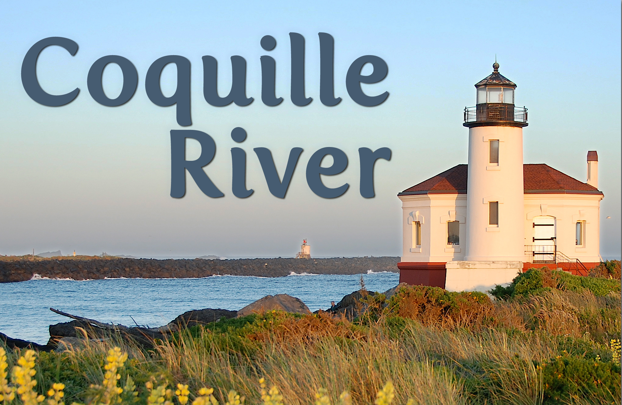
Located in Bullard’s Beach State Park just north of Bandon.
The area around the present-day town of Bandon was inhabited by the Coquille Indians. Settlers began to arrive in 1850, and after the arrival of immigrants from Bandon, Ireland in 1873, the town was named Bandon. The Coquille River empties into the Pacific Ocean near the town of Bandon—an area originally inhabited by the Coquille Indians. The river extends inland a great distance, and was a natural link to the virgin stands of timber in the area. The bar at the mouth of the river was a major obstacle for the ships entering the river. In 1880, Congress passed a bill providing for the construction of a jetty on the south side of the river’s entrance. The jetty created a clear channel in the river, prompting a rapid rise in the number of ships entering the river. Construction of the Coquille River Lighthouse was authorized in 1891, but it took four years to purchase the land, solidify the plans, and begin construction.
Cape Blanco Lighthouse
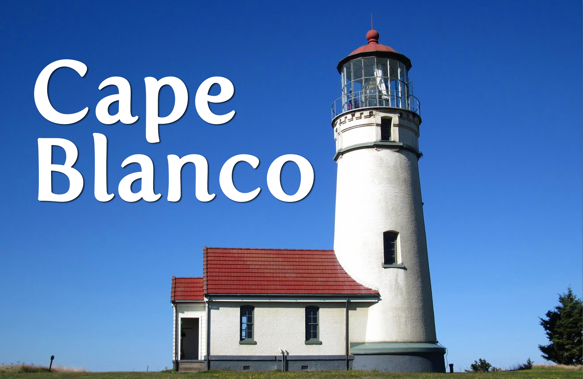
The southernmost of the Oregon lights, Cape Blanco Lighthouse is located about 65 miles from the California border, or a couple miles north of Port Orford.
Cape Blanco juts out one and a half miles into the Pacific Ocean from Oregon’s southern coast. At the end of the cape is a large headland with 200-foot cliffs along most of its perimeter. These chalky cliffs prompted early Spanish explorers to name this landmark, which is the most westerly point in Oregon, Cape Blanco or White Cape. Since the lighthouse was far from any harbor, its primary function was to warn ships away from the reefs, which extended from the cape, and to provide a position fix for navigators. The light from a powerful first-order Fresnel lens with a fixed, white signature served this function well.
Heceta Head Lighthouse
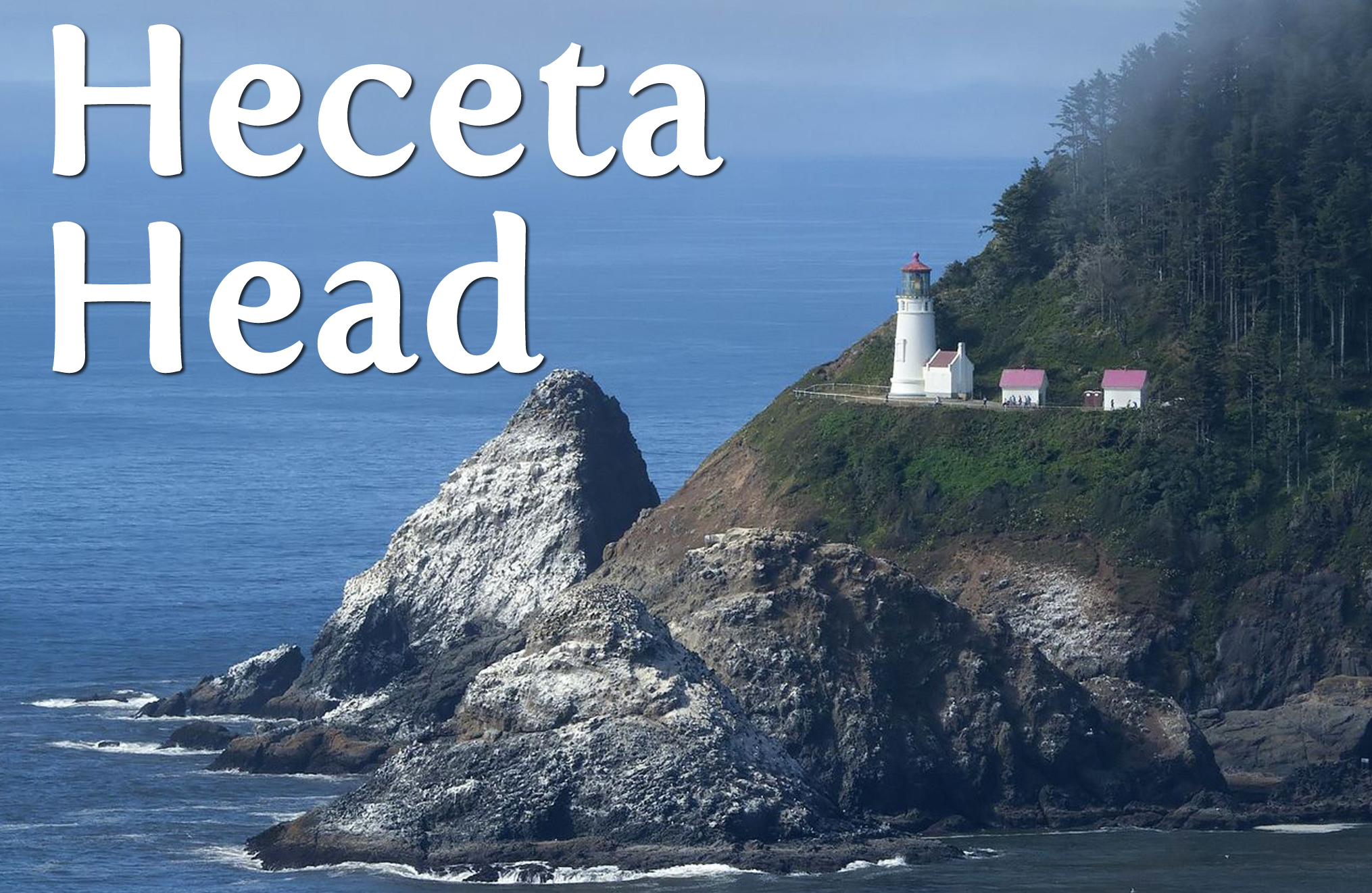
Located just off Highway 101, roughly eleven miles north of Florence and eleven miles south of Yachats.
Heceta Head Lighthouse is located on a breathtaking bluff 150 feet above the sea. It is one of the most visited lighthouses in the United Statesn drawing thousands of visitors each year to enjoy its spectacular view. Construction of the lighthouse began in 1892. Lumber came from local mills, the masonry and cement came from San Francisco, and rock used in the base of the tower was quarried from the Clackamas River near Oregon City. The tower is 56 feet tall with a focal plane of 205 feet above sea level. The most powerful light along the Oregon coast, the light can be seen 21 miles out to sea and is only stopped by the curvature of the earth. The light shown for the first time on March 30, 1894.
Tillamook Rock Lighthouse

Located 1.3 miles off the coast of Ecola State Park.
One mile west of Tillamook Head, a rock rises from the ocean with sheer cliffs that drop straight into the sea to depths of 96 to 240 feet. In June 1879 a lighthouse engineer boated out to the rock and determined that a lighthouse there would be feasible. The locals were skittish of the project and no local skilled workers could be found willing to work on the construction, so workers had to be brought in from other areas. All materials for the lighthouse were brought by boat and hauled up the rock by derricks. The structure originally was a one-story room, 48 x 45 feet with an extension for the fog signal equipment. Later a half story was added. A 16-foot square tower rising from the center of the building supports the lantern room and parapet, which housed a first-order Fresnel lens. The light shown 133 feet above the sea with a signature of a white flash every five seconds.